The brutal Decalibron loop gets its name from the four highest peaks along the route: Democrat, Cameron, Lincoln, and Bross. Located less than one hour away from Main Street, the Declibron is the perfect caper for adventurers seeking ideas for hiking in Breckenridge. The entire area is comprised of large, rolling hills and commanding mountain summits. Often times, the Democrat basin is so busy that the lower towns of Breck and Fairplay will seem sparsely populated.
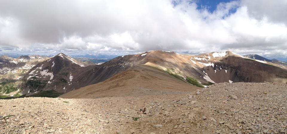
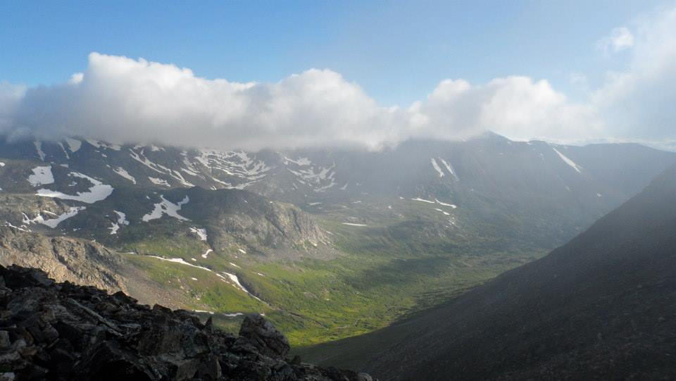
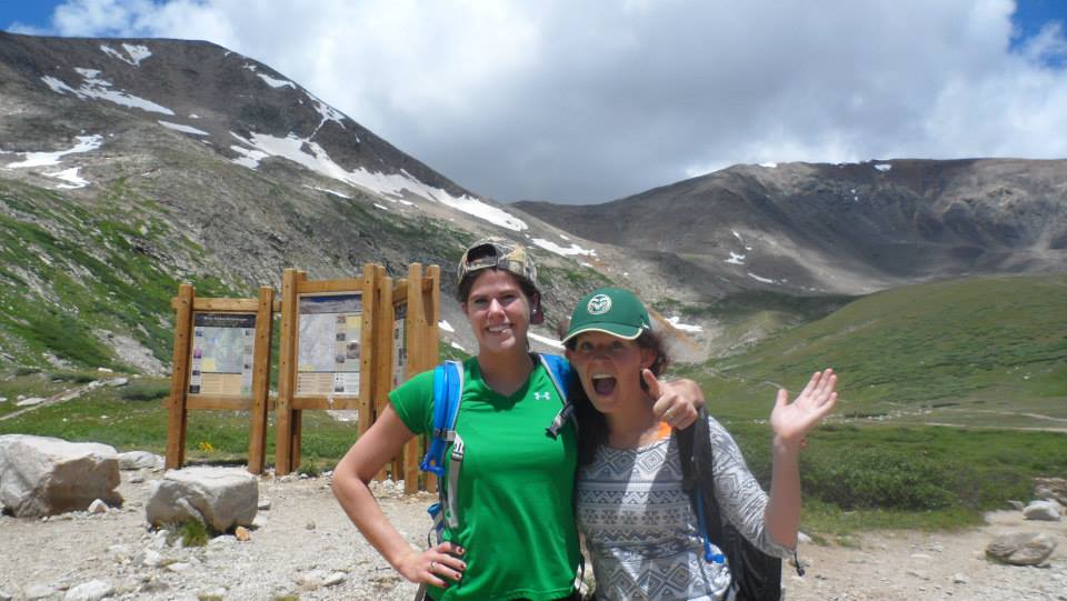
On July 17, 2014 Chloe and I embarked on our greatest 14er journey thus far. Returning once again to the Mosquito Range we were determined to defeat a southern combo of four 14ers. Comprised of 14,154’ Mount Democrat, 14,238’ Mount Cameron, 14,295’ Mount Lincoln, and 14,177’ Mount Bross, the Class 2 route was beckoning. While we did not pack any extra special gear for the long trek ahead, we were prepared for the extreme winds that come hand-in-hand with exposed, high-alpine climbs. We left our vehicle in the large parking area just before 7 AM. This was, admittedly, a tad too late in the day for the kind of climb we were aiming to complete. Starting out we followed the well-worn route through dense fog around the east side of Kite Lake. We traveled by multiple mine ruin sites before hitting the Democrat talus field that would lead us up and out of the basin. By this point, just after 8 AM, the heavy fog had not cleared and much of the route was not visible. Not to mention, we had not yet deciphered which of the several surrounding peaks were official summits. Just below the top of the basin, we stumbled upon an old mine prospect hole – it was pretty nifty. After only an hour of climbing, we reached the Democrat-Lincoln saddle and became overly optimistic of how close the first summit was.
From here, we traversed up rather steep terrain for a good forty minutes, walking dangerously close to the rocky ledge for most of the way up and picking which talus fields looked the most manageable. Finally, the final pitch gave way to easier terrain as we joined one other group and one very friendly dog at the summit. Personally, I was feeling extremely great about the rest of the trip. For the first time, altitude had not yet affected me and I eagerly awaited the next mountain. Chloe and I opted out of lunch at the first summit and instead chose to quickly push towards Cameron. We descended back down both the steep terrain and the Democrat-Cameron saddle before hiking nightmarish northeast ridge up to Cameron (the high-point of the route). Now, I was exhausted and hating myself. We stopped frequently and often on the way up to Cameron, wondering how on earth we were supposed to summit three more mountains. Thankfully, we arrived at a rather awkwardly flat summit and managed to find two gentlemen to take our picture. They were also kind enough to point out which mountains were Lincoln and Bross. Despite the fact that the ascent up to Cameron took us nearly twice as long as the climb up Democrat, we decided to head over to Lincoln before taking our lunch break. So, we quickly waved into the distance towards the visible Quandary summit and vacated the Cameron presmises.
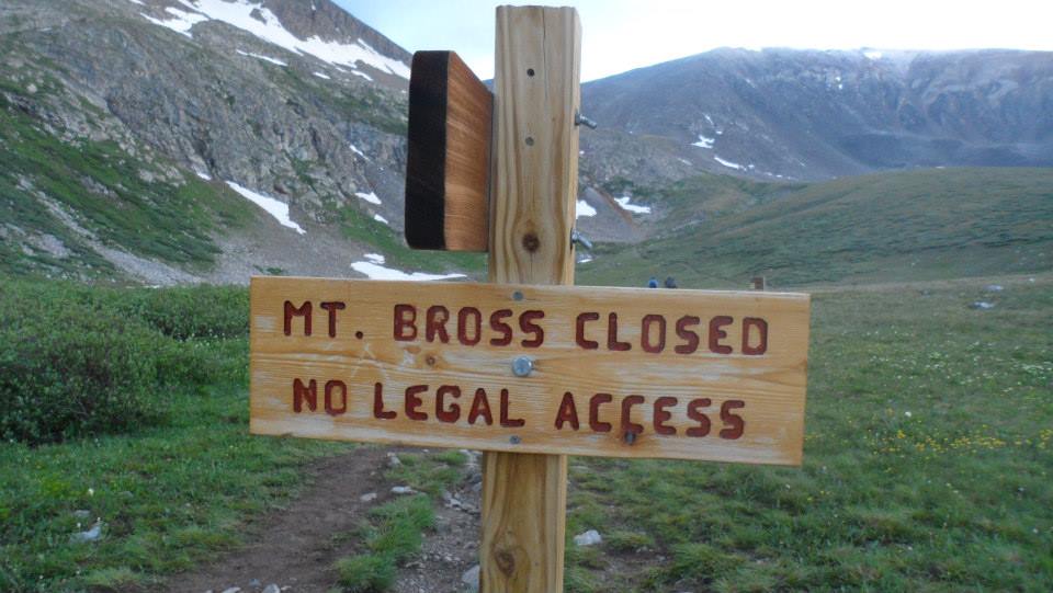
Making it to Lincoln was easy. The Cameron-Lincoln saddle was downhill and we only had to pass over two manageable bumps before summiting our third mountain of the day. Finally, we allowed ourselves to sit down and replenish our bodies with much needed nutrients. Once we had reenergized both physically and mentally we began the final route to Bross. We hiked back across the Cameron-Lincoln saddle and resummited Cameron before swinging left towards the west ridge of Bross. We continued south of the summit before crossing a gully. Because Mount Bross is privately owned, the route to the summit has not yet been clearly defined. Luckily for us, we were following two other climbers who seemed to know which way to go. Our little group ventured up the south face of Bross, battling high winds and exhaustion. But, at last Chloe and I summited our fourth and final 14er of the day and the descent from Bross was the only remaining task.
The trail back down to Kite Lake was narrow and rocky. At some points, it proved to be too steep for us as we both occasionally slipped here and there. We made it safely, however, back to my car just seven hours after the trip began. Looking back at the peaks, we agreed that it was a good thing that the fog prevented us from seeing the daunting route that we had successfully conquered.
*Disclaimer, the summit of Bross and its surrounding trails are not open to the general public.
©Jenna Lowery
Directions from Breckenridge: Drive south on CO-9 until you reach Alma. In the middle of town and on the west side of the road, look for a small sign for the road to Kite Lake. Turn here and drive through a residential area. Continue 6 miles to Kite Lake.